Laugavegur Trail: The Ultimate Guide to Iceland’s Hiking Gem
Planning to hike the Laugavegur Trail in Iceland? Learn everything you need to know — including difficulty, itinerary, terrain, gear, and route overview.
.webp&w=1920&q=75)
Quick links
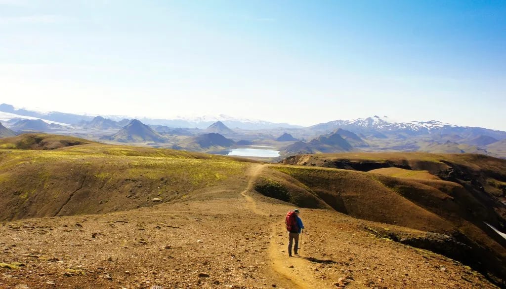
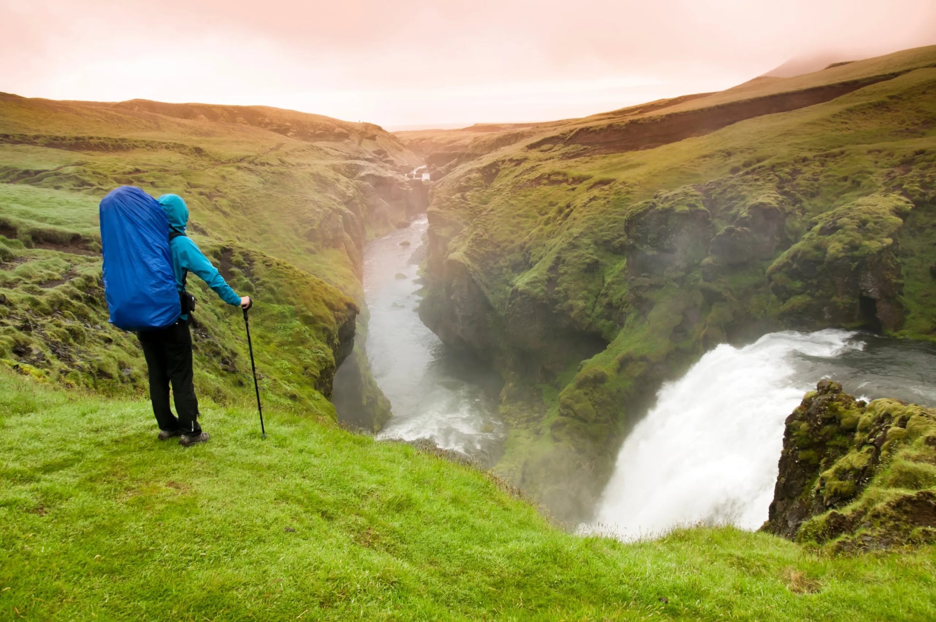
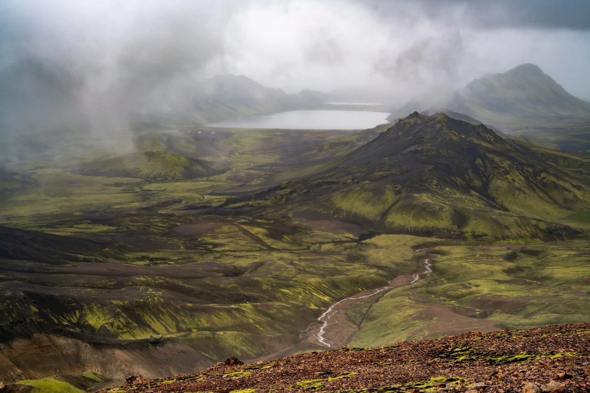
The Laugavegur Trail is Iceland's most renowned multi-day trek, spanning 55 km through the diverse landscapes of the Southern Highlands.
Starting from the geothermal wonderland of Landmannalaugar and culminating in the verdant valley of Þórsmörk, this trail lets you experience Iceland's raw and varied wilderness: steaming geothermal valleys, colorful rhyolite mountains, black volcanic deserts, and glacial rivers.
Most hikers find the Laugavegur Trail a reachable goal to complete in 4-5 days. The real questions however are: how to approach it, how difficult is it, and is it right for you?
Laugavegur Trail in Numbers
Length: ~55 km (34 miles)
Elevation gain/loss: cca. 1701 m (5,583 ft)
Duration: 4-5 days
Best time: July-August
Difficulty: Moderate
Start/finish: Landmannalaugar/Þórsmörk (Thorsmork)
Map
Route Overview
Elevation profile
The trail starts at ~600 m in Landmannalaugar, climbs to ~1,050 m at the Hrafntinnusker high point on Day 1, then trends downhill the rest of the way to ~200 m at Þórsmörk. Most of the total elevation gain is on Day 1.
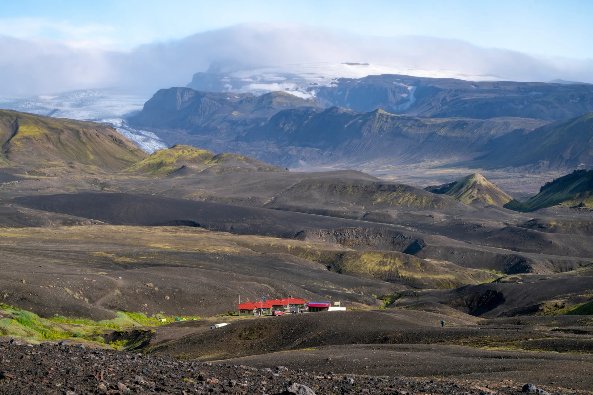
Key stops along the trail
Six huts spaced along the route serve as the natural overnight stops: Landmannalaugar → Hrafntinnusker → Álftavatn → (Hvanngil) → Botnar/Emstrur → Þórsmörk. Most hikers spend four nights and skip Hvanngil. Þórsmörk itself has three separate lodge clusters — Volcano Huts, Húsadalur, and Langidalur — so confirm which one your departure bus leaves from before you book.
Demarcation
The route is marked with cairns and wooden stakes. In highland fog, the markers can disappear at fifty meters — carry a paper map or a GPS app with offline data (on our tours, we provide it for you). Start each day early; weather windows are smallest in the afternoon.
Why Hike the Laugavegur Trail?
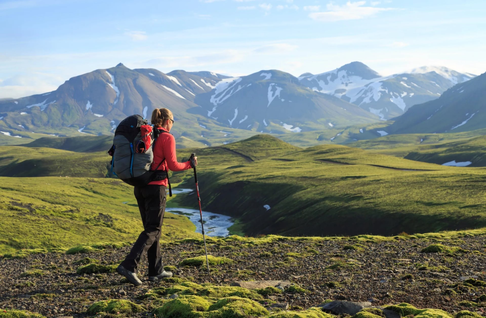
The Laugavegur is Iceland's signature multi-day walk for one reason: extraordinary landscape diversity. Over the 4–5 days, you’ll hike through steaming geothermal valleys, cross glacial rivers, and finally reach the lush green valley of Þórsmörk — one of the most dramatic landscape transitions in Iceland.
It runs hut-to-hut, and you don't need to be a hardened mountaineer to walk it — just fit enough for long days with a pack and ready for Iceland's weather.
You should hike the Laugavegur if you:
can hike 10–15 km a day for 4–5 days with a backpack.
are prepared for any weather.
are comfortable with unbridged river crossings.
are happy sleeping in a mountain hut or tent.
You should skip the Laugavegur if you:
want easy day hikes from a hotel base.
are not comfortable with river crossings.
can't commit to 4–5 days off-grid.
want real solitude.
The Trail’s Significance
The trail itself has been a vital passageway for centuries. Originally used by Icelanders to travel between various regions, it has played a significant role in the country's history, serving as a conduit for trade and communication.
The Southern Highlands that the Laugavegur runs across are steeped in Icelandic folklore. Tales of elves, trolls, and huldufólk — the "hidden people" — are traditionally tied to landscapes like these.
The geothermal area of Landmannalaugar is not only a natural wonder but also a testament to Iceland's volcanic activity, which plays a significant role in shaping the country's culture and lifestyle. The hot springs and unique geological formations are deeply intertwined with Icelandic traditions of nature reverence and sustainability.
Trail Itinerary and Daily Breakdown
Day 1: Landmannalaugar to Hrafntinnusker
Distance: 12 kilometers
Time: 4 hours
Difficulty: 3/5 (technical), 1/5 (fitness)
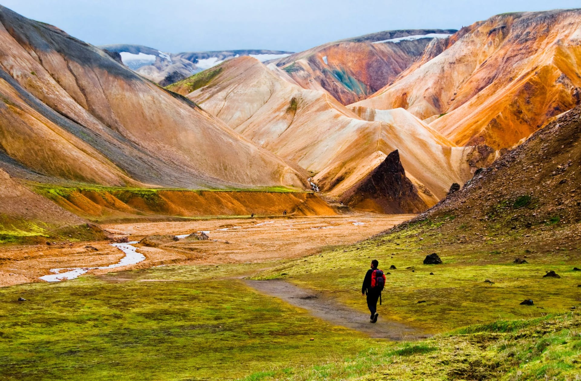
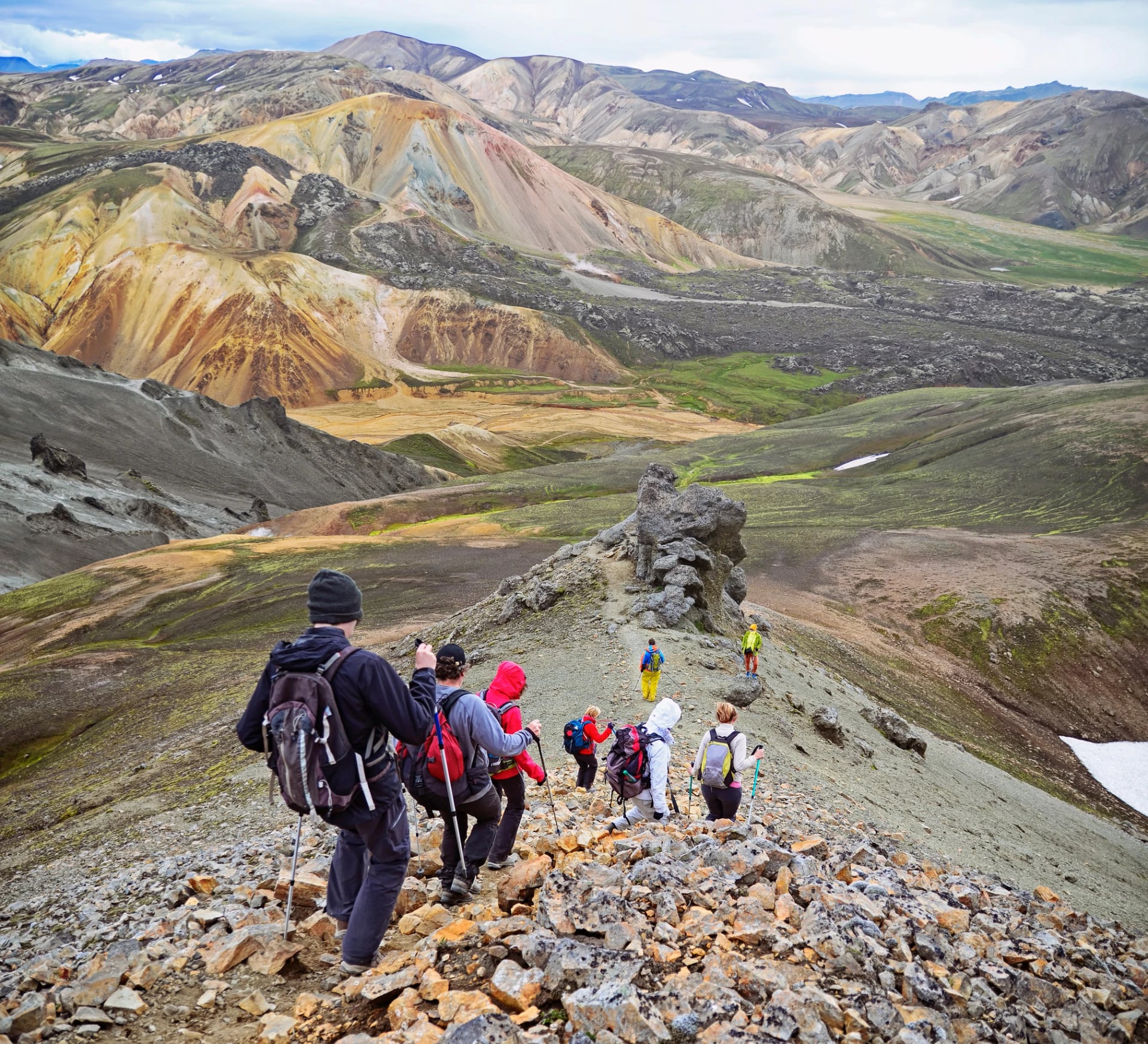
Terrain: This segment introduces hikers to the colorful rhyolite mountains of Landmannalaugar. The trail ascends through lava fields and geothermal areas, offering stunning views.
Day 2: Hrafntinnusker to Álftavatn
Distance: 12 kilometers
Time: 4 hours
Difficulty: 3/5 (technical), 1/5 (fitness)
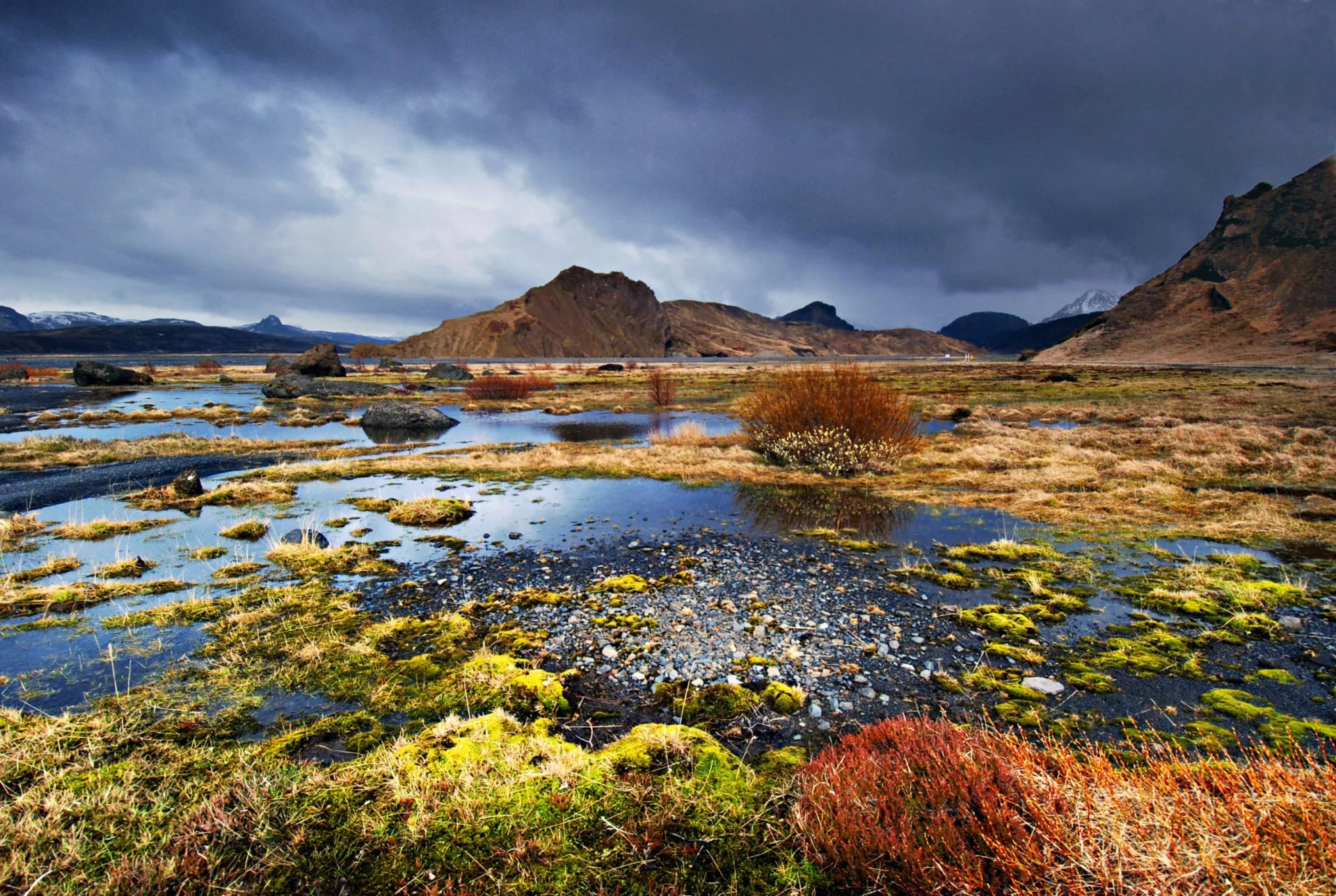
Terrain: The trail descends from the highlands, transitioning into a valley with a picturesque lake, Álftavatn.
Day 3: Álftavatn to Emstrur
Distance: 15 kilometers
Time: 6 hours
Difficulty: 3/5 (technical), 3/5 (fitness)
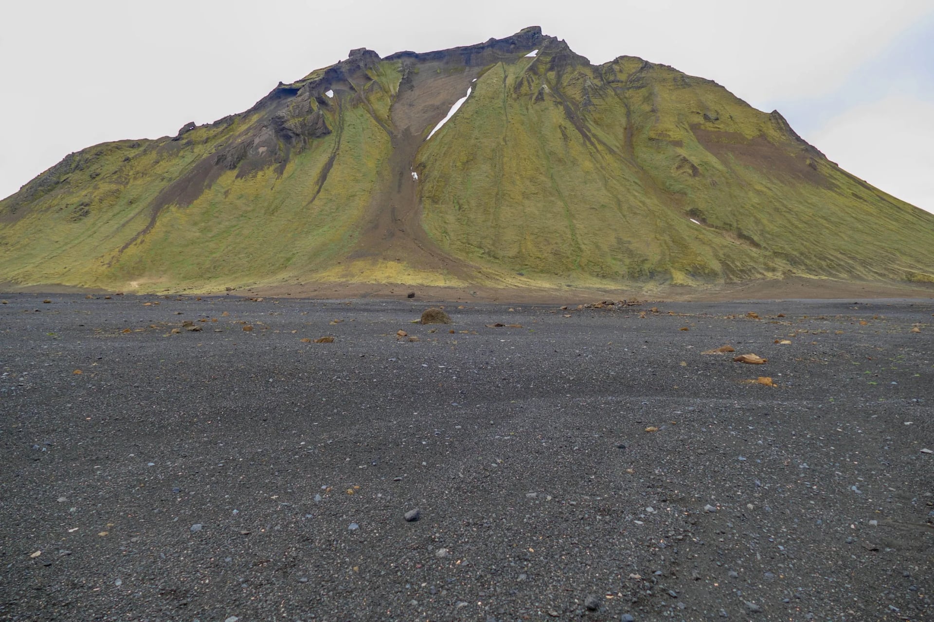
Terrain: The landscape shifts to black sand deserts and volcanic fields, offering a stark contrast to the earlier part of the trail.
Day 4: Emstrur to Þórsmörk
Distance: 15 kilometers
Time: 6 hours
Difficulty: 3/5 (technical), 3/5 (fitness)
Terrain: The final day features diverse landscapes, including lush valleys and birch forests as hikers approach Þórsmörk.
Difficulty
Fitness: 3/5 · Technical: 3/5
Moderate on both fronts — not extreme, not casual. Tens of thousands of hikers complete it each year, which tells you it's accessible. What makes it demanding isn't any single challenge; it's the cumulative load of 4–5 long days back-to-back, carrying everything you'll eat and sleep with.
Technical difficulty
No technical climbing. No ropes, no crampons, no specialized equipment. The path is walkable and well-marked.
What it does ask for:
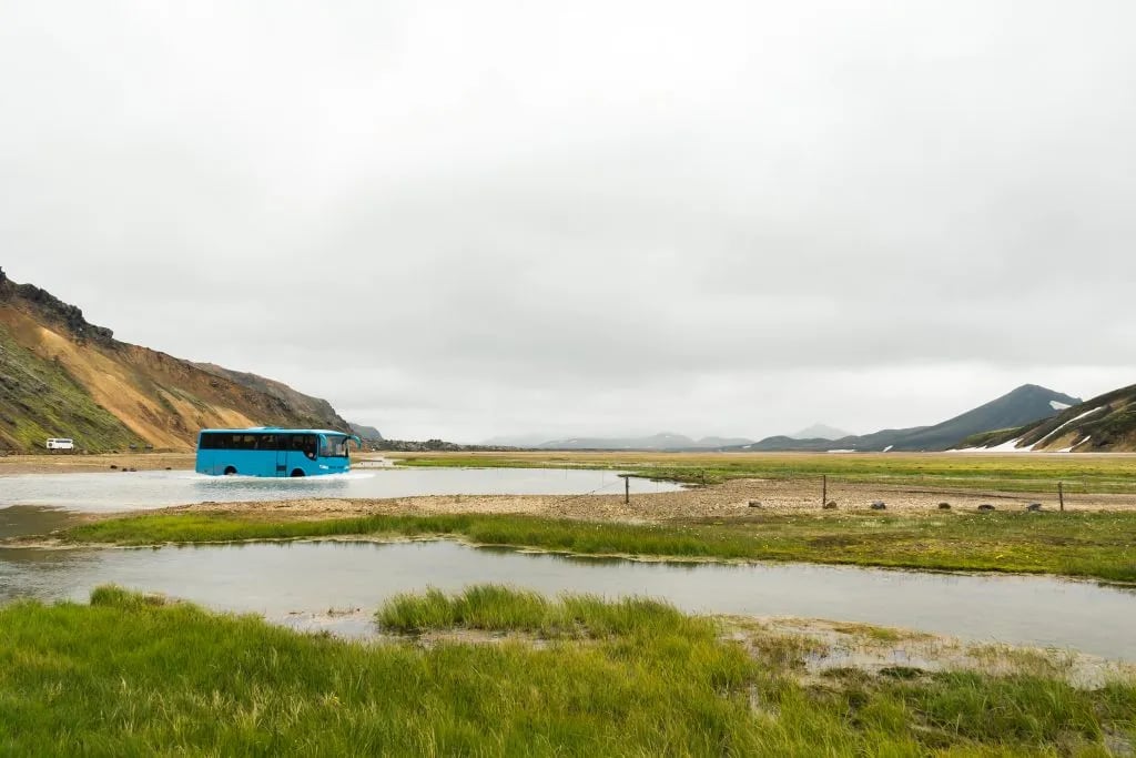
Unbridged glacial river crossings
Several fords across the route, calf- to thigh-deep depending on the day's weather and the time of season. Water shoes or neoprene socks are essential; trekking poles help against the current.
Snowfields early in the season
The Hrafntinnusker section holds snow into July most years. Not crampon territory, but it asks for balance and good judgment.
Weather-driven exposure
When fog or wind drops in across the highlands, visibility goes quickly. The trail itself stays fine — what changes is your decision-making.
If you're reasonably comfortable on rough ground without handrails, you'll manage. If you've never forded a glacial river before, you'll learn on Day 2.
Physical fitness
The trail is relatively short at 55 km, but it's a demanding multi-day hike. You'll walk 4–6 hours a day, with likely no resupply between huts — every meal and every layer is on your back.
You have to be in a hiker's shape to comfortably tackle the trail, which involves daily hikes of approximately 10 to 15 kilometers over varying terrain. Regular cardiovascular exercises such as running, cycling, or brisk walking, ideally started several weeks before the hike, are effective.
Include long hikes in your regimen, simulating the trail conditions with a loaded backpack if possible. This will build stamina and help you adapt to carrying the weight you'll have during the hike.
Alternatives
Easier: the Víknaslóðir Trail in the East Fjords — the same hut-to-hut, multi-day format, but with shorter days and far less traffic. Or the South Coast Highlights 7-day inn-based tour — waterfalls, glaciers, and Jökulsárlón without committing to mountain huts.
Harder: the Laugavegur + Fimmvörðuháls (79 km / 6 days) — the same trail through Day 4, then a dramatic high-pass extension between two glaciers, finishing at Skógafoss. For a step beyond — solitude, route-finding, full self-support — Hornstrandir in the far Westfjords is the genuine wilderness option.
Preparation and Planning
Best time to go
The hiking season in Icelandic highlands runs from roughly mid-June to mid-September, when the mountain huts are open and the buses to Landmannalaugar are running. Within that window, you have three real options:
Mid-June to early July
Snow patches still hold on the Hrafntinnusker section, rivers run higher from spring snowmelt, and nights are cold. Quietest of the three — but the trail asks more of you.
Read more early season tips in our June hiking blog.
Late August to mid-September
Autumn color starts to come in, traffic drops, but the weather turns less predictable and bus schedules begin to taper. Bring extra layers and a flexible itinerary.
See our September blog for more in-depth information.
If you can only do one trip and want the most reliable conditions, late July through mid-August is the sweet spot.
For a full breakdown of how each month feels in Iceland — daylight, weather, road access, what's open — see our complete guide to when to hike in Iceland.
Gear and clothing
Given Iceland's unpredictable weather, waterproof and windproof clothing is essential. Sturdy hiking boots, well broken-in to prevent blisters, will be invaluable over rough terrain.
For river crossings, lightweight water shoes are necessary to protect your feet from the cold, rocky riverbeds. Other essentials include warm clothing layers like fleece or wool, a hat, gloves, and extra socks to keep warm and dry.
Backpacking essentials
A comfortable, well-fitting backpack is crucial as you'll be carrying it for several days. Equip it with a rain cover to protect your belongings. For sleeping arrangements, a lightweight but warm sleeping bag is needed, even when staying in huts. Campers will also need a durable tent, a sleeping mat, and cooking equipment.
Food and water
Pack lightweight, high-energy foods like nuts, dried fruits, energy bars, and ready-to-eat meals. While the water in streams is generally safe to drink, carrying a water purification method, like tablets or a filter, is advisable for safety. Ensure you have a durable water bottle or hydration system.
By addressing these key areas in your preparation, you can look forward to an enjoyable and memorable experience on the Laugavegur Trail.
Getting There
Accessing the Laugavegur Trail involves reaching its start point at Landmannalaugar. The most common method of transportation is by bus from Reykjavik, the capital of Iceland. The journey typically takes around 3 hours and traverses gravel roads and river crossings.
Two main bus companies provide this service, each equipped with vehicles suitable for the rugged Icelandic terrain. Tickets can be purchased in advance, which is advisable during peak hiking season.
For the return journey, buses are available from Þórsmörk, the trail's endpoint, back to Reykjavik. It's important to note the schedule and availability of these buses, particularly if you're hiking independently, to ensure a smooth return trip.
Those planning to extend their hike beyond Þórsmörk, such as taking the additional Fimmvörðuháls trail to Skógar, should also plan their return transportation accordingly, as the endpoint will differ from the standard Laugavegur route.
Accommodations
On the Laugavegur Trail, hikers have two main types of accommodations: mountain huts and camping sites.
The mountain huts are basic yet comfortable shelters that provide respite from the unpredictable weather. These huts include bunk beds, communal kitchens, and basic sanitary facilities. Given their popularity, especially during peak season from June to August, it is essential to book these well in advance.
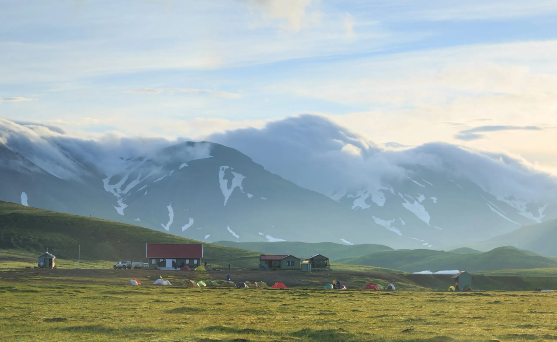
Adjacent to each hut, there are designated camping areas for those preferring a closer encounter with nature. These sites allow access to the hut's facilities, including toilets and water. Some offer showers for an additional fee. Unlike hut reservations, camping spots usually don't require advance booking, but they can get crowded, so arriving early is recommended.
Whether opting for the relative comfort of a hut or the adventurous appeal of camping, hikers are expected to be self-sufficient, including carrying sleeping bags and, especially for campers, their cooking equipment.
Adhering to the environmental conservation rules and using designated areas for tents is crucial to preserve the trail's pristine nature.
Laugavegur Mountain Huts
1. Landmannalaugar Hut
Location: At the trail's starting point amidst geothermal hot springs.
Capacity: 78 people
Facilities: Has dormitory-style sleeping, kitchen facilities, and nearby natural hot springs for bathing.
2. Hrafntinnusker Hut
Location: Higher in the mountains.
Capacity: 52 people
Facilities: Basic amenities with shared sleeping areas. Due to its high altitude, it's often surrounded by snow, even in summer.
3. Álftavatn Hut
Location: Beside the picturesque Lake Álftavatn.
Capacity: 72 people
Facilities: Offers a more expansive setup with sleeping arrangements and kitchen facilities and is known for its scenic surroundings.
4. Hvanngil Hut
Location: Situated in a green valley, offering a break from the volcanic landscapes.
Capacity: 60 people
Facilities: Includes standard hut amenities and is a popular stop before the more arid sections of the trail.
5. Botnar/Emstrur Hut
Location: Set in a more barren, desert-like part of the trail.
Capacity: 60 people
Facilities: Basic hut provisions, serving as a crucial stop before the final stretch to Þórsmörk.
6. Þórsmörk Hut
Location: In the lush valley of Þórsmörk, surrounded by forests and rivers.
Capacity: 75 people
Facilities: More comprehensive amenities, often used as a base for exploring the valley.
Navigation
Successfully navigating the Laugavegur Trail requires awareness of the trail's characteristics and environmental conditions. The path is well-marked, reducing the likelihood of getting lost, yet it's always prudent to carry a detailed map or GPS device.
This is especially important as weather conditions in the Icelandic highlands can change rapidly, potentially impacting visibility.
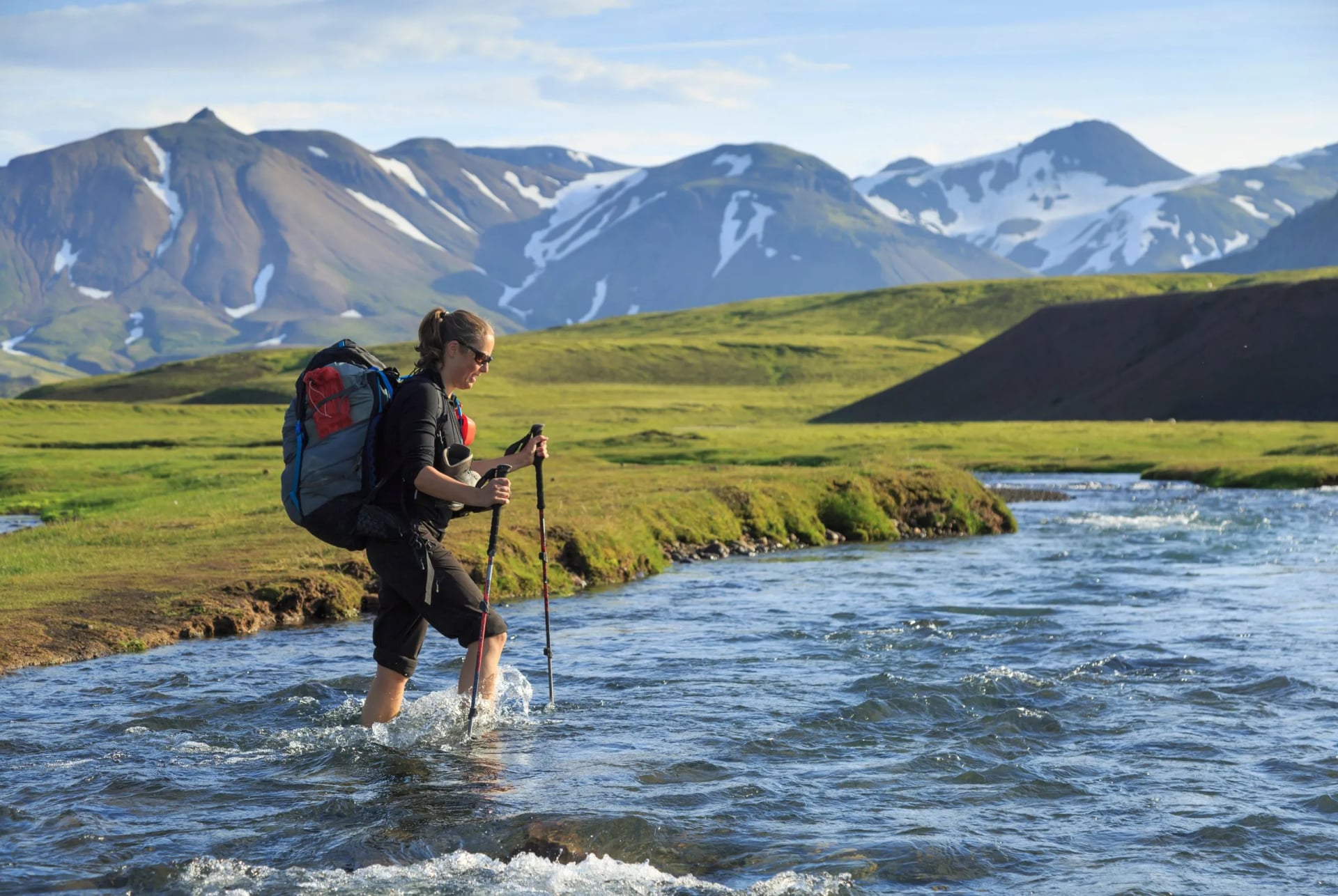
The trail presents a variety of unique challenges, from river crossings to steep ascents and descents. While most rivers have footbridges, some require fording, especially in the later sections of the trek. Wearing appropriate water shoes and exercising caution during these crossings is vital for safety.
The trail's terrain varies significantly, ranging from smooth paths to rocky and uneven sections. The initial part of the trek involves a significant elevation gain, which can be physically demanding.
Moreover, hikers should plan each day's journey considering their pace, weather conditions, and the distance between huts or camping sites. It's advisable to start each day's hike early to allow ample time for unexpected delays or to enjoy the scenic beauty along the way.
Safety Considerations and Weather
Weather plays a crucial role in the hiking experience on the Laugavegur Trail. It's known for its unpredictability, with the possibility of encountering rain, wind, and even snow, regardless of the season. Hikers should be prepared for all types of weather and have suitable gear, including waterproof clothing and layers for warmth.
The key to a safe hike is preparation. This includes having the right gear, being aware of the weather forecast, and understanding the trail's challenges. Carry a map or GPS device, adequate food and water, and a first-aid kit. Ensure your clothing and equipment are suitable for Iceland's variable weather conditions.
Check weather forecasts and current conditions regularly.
Wildlife
The Laugavegur Trail takes hikers through various ecosystems, each hosting unique flora and fauna that add to the trail's allure.
The trail's vegetation is a testament to Iceland's diverse habitats. In the geothermal area of Landmannalaugar, hikers can observe a range of mosses and hardy grasses thriving in the warm soil. As the trail ascends, the vegetation becomes sparser, with lichens and small shrubs adapting to the harsher conditions.
In the valleys and lower altitudes, especially around Þórsmörk, the landscape is dotted with birch forests and various flowering plants, adding splashes of color to the terrain.
While the highlands of Iceland are not teeming with wildlife, there are still opportunities to observe some interesting species. Birds are the most common sight, with species such as the Golden Plover, Arctic Tern, and the Raven often spotted along the trail.
The rivers and streams may host various waterfowl, while the Þórsmörk valley provides a habitat for a greater variety of birds owing to its richer vegetation.
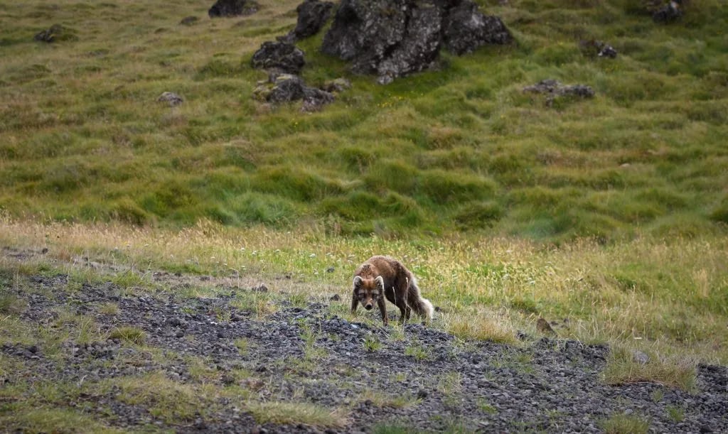
Mammalian wildlife is less visible, but hikers might catch a glimpse of the Arctic Fox, especially around dawn or dusk. These elusive creatures are the only native land mammals in Iceland and are known for their beautiful fur, which changes color with the seasons.
The ecosystems along the Laugavegur Trail are fragile. Hikers are encouraged to observe wildlife from a distance, avoid disturbing animals, and adhere to the path to protect the vegetation.
The Laugavegur Trail With Us
Planning a Laugavegur trek means chasing chained hut bookings, coordinating bus transfers, and pacing the stages around hut availability — work that takes weeks and starts in late autumn for the following summer.
If you'd rather hand that off, our self-guided Laugavegur tours handle it. Each booking includes a paced itinerary, chained hut nights, a pre-loaded GPS route in our app, luggage transfer where possible, and 24/7 support on the trail.
Opting for an alternative? See all our self-guided tours in Iceland.


HASSLE FREE
We handle itineraries, accommodations, and anything else you prefer not to deal with, so you can enjoy a carefree hike.

BOOK WITH CONFIDENCE
We are a financially protected company, fully bonded and insured, keeping your money safe and allowing you to travel with confidence.

TRIED & TESTED ADVENTURES
Only the best hut to hut hikes in the USA, cherry-picked by our local team with an in-depth knowledge of the region.

UNBEATABLE SUPPORT
Our 24/7 customer support is where we show our passion, bringing you a better experience by making your well-being our number one priority.