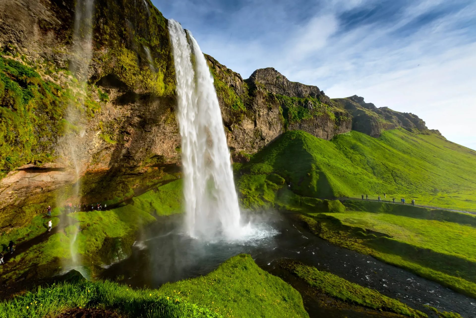
Iceland in August: Late Summer Hiking and the Season’s End
August is one of the best times of year for hiking in Iceland — here is what to know if you're visiting in the last full month of the hiking season.

Anja
Published May 5, 2026
Edited May 5, 2026
16 min read
-(1).jpeg&w=1920&q=75)
Quick links
Iceland's national parks protect some of the most extraordinary landscapes on Earth — the continental rift where Europe and North America pull apart, the largest ice cap outside the polar regions, and a glacier-capped volcano immortalized in Jules Verne's fiction.
Together, Iceland has three national parks:
Þingvellir National Park,
Vatnajökull National Park, and
Snæfellsjökull National Park.
They cover roughly 15% of Iceland and pack in nearly everything the country is famous for: roaring waterfalls, black sand beaches, steaming geothermal fields, Viking-age history, and some of the best hiking on the planet.
Quick Facts
Iceland has three national parks, each protected by the country's Environment Agency (Umhverfisstofnun) and managed under the Nature Conservation Act. Unlike some countries, Iceland's parks are not numbered or ranked — each protects a distinct ecosystem and cultural heritage.
National Park | Established | Size | Region | UNESCO Status |
Þingvellir | 1930 | 237 km² | Southwest (Golden Circle) | World Heritage Site (2004) |
Vatnajökull | 2008 | ~14,200 km² | East/South/North (vast) | World Heritage Site (2019) |
Snæfellsjökull | 2001 | 170 km² | West (Snæfellsnes Peninsula) | — |
Vatnajökull alone covers about 14% of Iceland's total landmass, making it the largest national park in Western Europe. Two earlier parks — Skaftafell (1967) and Jökulsárgljúfur (1973) — were absorbed into Vatnajökull when it was created in 2008.
1. Þingvellir National Park: Where Continents Part and a Nation Was Born
Most known for: The dramatic rift between the North American and Eurasian tectonic plates, and the founding site of the world's oldest parliament (Alþingi, 930 AD).
Best for: First-time visitors, history buffs, Golden Circle day-trippers, and snorkelers/divers at Silfra.
.jpeg&w=1920&q=85)
Þingvellir (Thingvellir) is the most visited national park in Iceland, and for good reason. It sits just about 45 km east of Reykjavík, forms the first stop on the famous Golden Circle route, and is the only place on Earth where you can stand between the North American and Eurasian tectonic plates as they pull apart at roughly 2 cm per year.
Þingvellir is also where Icelanders established the Alþingi (Althing) in the year 930 AD — one of the oldest parliamentary institutions in the world. For nearly nine centuries, chieftains from across Iceland gathered here each summer to make laws, settle feuds, and trade.
The name itself translates to "parliament fields." In 1944, Icelanders returned to Þingvellir to declare independence from Denmark, and exactly 60 years later, UNESCO inscribed it as a World Heritage Site.
Practical Info for Þingvellir
Entry fee: Free (parking is paid).
Visitor centers: Hakið (main, near the Almannagjá overlook) and a smaller center at Leirar.
Opening hours: The park is open year-round, 24/7. Visitor centers operate daily in summer, shorter hours in winter.
Toilets: At all main parking areas — bring coins or a card for paid facilities.
What to See and Do in Þingvellir
Hiking in Þingvellir
Þingvellir is not a hiking destination in the alpine sense, but it rewards slow exploration.
The Almannagjá–Lögberg–Öxarárfoss loop takes about an hour and covers the cultural and geological highlights. More ambitious walkers can follow marked paths along the eastern shore of Þingvallavatn or climb Arnarfell, a small peak inside the park with 360° views. Ascent of the nearby Ármannsfell (764 m) just outside the park boundary is a half-day effort with wildflower meadows in summer.
Want to hike Þingvellir as part of a longer Iceland trip? Experience it on our tour:
2. Vatnajökull National Park: Europe's Largest Icecap
Most known for: Europe's largest ice cap by volume, sitting atop ~30 active volcanoes, plus the Jökulsárlón glacier lagoon and Dettifoss waterfall.
Best for: Serious hikers, glacier and ice cave adventurers, photographers chasing scale, and travelers with a week of time or more.
If Þingvellir is Iceland's historical heart, Vatnajökull National Park is its wild soul. Established in 2008 and expanded several times since, it now covers more than 14,000 square kilometers — an area larger than Connecticut, and nearly the size of Montenegro. At its center sits Vatnajökull, the largest ice cap in Europe by volume, hiding around 30 active volcanoes beneath up to 1,000 meters of ice.
UNESCO added Vatnajökull to the World Heritage list in 2019. Its dynamic interaction between the ice cap and subglacial volcanism is a force that has sculpted canyons, triggered catastrophic jökulhlaup floods, and built entire landscapes within living memory.
The park is enormous and logistically divided into four main regions, each with its own visitor center and character. Plan your visit around regions, not the whole park.
Practical Info for Vatnajökull
Entry fee: Free. Parking fees apply at Skaftafell and some other trailheads.
Camping: Designated campgrounds at Skaftafell, Svínafell, Ásbyrgi, and Dettifoss-west. Wild camping inside the park requires permission.
Huts: Book well ahead via Ferðafélag Íslands or local clubs.
Access: South via Route 1 (paved, year-round). North via Route 1 and Route 862 (862 is gravel and rough in places). Highlands via F-roads (4×4 and high clearance required, summer only).
The Four Regions of Vatnajökull
Southern Territory
Landmarks: Skaftafell, Jökulsárlón, Lónsöræfi
The most visited and accessible region, reached via the Ring Road about 4.5 hours east of Reykjavík. Skaftafell is the gateway to the classic glacier-tongue hikes, the basalt waterfall Svartifoss, and the mountain views of Kristínartindar. Further east, the Jökulsárlón glacier lagoon and Diamond Beach are among the most photographed spots in the country. The territory also extends to the remote Lónsöræfi wilderness — a hiker's paradise of rhyolite mountains and unbridged rivers.
Visitor centers: Skaftafellsstofa (main), Gamlabúð in Höfn (eastern stretch)
Eastern Territory
Landmarks: Snæfell, Kverkfjöll, Snæfellsöræfi
The wildest and least-visited region, covering the northeastern flank of the ice cap. Snæfell (1,833 m) is Iceland's tallest free-standing peak, dominating a plateau where wild reindeer roam. Kverkfjöll, a remote geothermal area on the ice cap's northern edge, is accessible only by 4×4 in summer.
Visitor center: Snæfellsstofa at Skriðuklaustur
Northern Territory
Landmarks: Jökulsárgljúfur, Ásbyrgi, Dettifoss, Askja
It is the park's geographically separate section. Anchored by Ásbyrgi, a horseshoe-shaped canyon carved by glacial floods over thousands of years — Norse mythology says Odin's horse Sleipnir made the hoofprint. South of the canyon, the Jökulsá á Fjöllum river thunders over Dettifoss (193 m³/s), often called Europe's most powerful waterfall by volume, though some rank it second after the Rhine Falls. Nearby Selfoss, Hafragilsfoss, and the Hljóðaklettar ("echo rocks") basalt formations round out an afternoon's exploring. Further inland, the Askja caldera holds the geothermally heated Víti crater lake (~25 °C, though swimming is sometimes restricted) — 4×4 access only.
Visitor center: Gljúfrastofa at Ásbyrgi
Western Territory
Landmarks: Lakagígar, Langisjór
The least-developed of the four, covering the southwestern flank of the ice cap. The Lakagígar fissure was the site of the catastrophic 1783–84 eruption that triggered the Móðuharðindin ("Haze Famine"). Mostly highland and accessible only by 4×4 vehicles in summer.
Visitor center: Skaftárstofa at Kirkjubæjarklaustur
Must-Do Hikes in Vatnajökull National Park
Svartifoss Loop (Skaftafell). The classic 1.5–2 hour round trip from the Skaftafellsstofa visitor center to the black basalt-column waterfall. Easy, well-marked, suitable for families. Extend it into a loop via the Sjónarsker viewpoint for panoramic views of Skaftafellsjökull, an outlet glacier that earned the nickname "Hollywood glacier" for its appearances in Batman Begins, Interstellar, Game of Thrones and others.
Kristínartindar (Skaftafell). A full-day 18-km loop climbing to a 1,126 m ridge with staggering views over Svínafellsjökull glacier and Öræfajökull volcano. Moderately strenuous, marked, and one of the best single-day hikes in Iceland.
Fimmvörðuháls (Skógar–Þórsmörk). Technically outside Vatnajökull National Park but essential to mention — this 25-km traverse crosses a 2010 eruption site. Pair it with the Laugavegur trail for a legendary 4–5 day hike through southern Iceland.
Ásbyrgi to Dettifoss. A 34-km, 2-day canyon traverse along the Jökulsá á Fjöllum river. Camp or stay in the hut at Vesturdalur. One of Iceland's finest backcountry routes, with basalt amphitheaters, hoodoos, and wildflower meadows in July.
Lónsöræfi Traverse. A demanding 4–5 day route through the remote Stafafell wilderness on the park's eastern edge. Colored rhyolite mountains, unbridged rivers, and hut accommodation in Múlaskáli and Egilsselur. For experienced hikers only.
Glacier hikes and ice caves. Licensed guides run glacier walks on Svínafellsjökull, Falljökull, and Breiðamerkurjökull year-round. Ice cave tours operate November through March. These are not DIY activities — crevasses and rapidly changing conditions make guided tours mandatory.
Experience Vatnajökull on our tours:
3. Snæfellsjökull National Park: Fire, Ice, and Fiction
Most known for: The glacier-capped stratovolcano made famous by Jules Verne, and the "Iceland in miniature" peninsula.
Best for: Travelers short on time who want variety in one loop — all within a day's drive of Reykjavík.
The smallest of Iceland's national parks, Snæfellsjökull occupies the western tip of the Snæfellsnes Peninsula, about 2.5 hours northwest of Reykjavík. At its heart rises the Snæfellsjökull volcano, a 1,446-meter glacier-capped stratovolcano that Jules Verne chose as the entry point for Journey to the Center of the Earth in 1864. On a clear day, you can see its unmistakable white cone from Reykjavík across Faxaflói Bay.
Snæfellsjökull is sometimes called "Iceland in miniature" because the peninsula packs the country's most iconic landscapes — glaciers, black beaches, lava fields, fishing villages, and seabird cliffs — into a 90-kilometer loop you can drive in a day.

Practical Info for Snæfellsjökull
Entry fee: Free, including parking at most trailheads.
Visitor center: Snæfellsstofa is actually in east Iceland (part of Vatnajökull). For Snæfellsjökull, stop at Malarrif (summer only, daily 10:00–17:00) or the Hellnar tourist info cabin.
Driving time from Reykjavík: ~2h 30min via Route 54.
Accommodation: Hellnar, Hellissandur, Arnarstapi, and Ólafsvík all have guesthouses and a few hotels. Campgrounds at Arnarstapi and Hellissandur.
What to See and Do in Snæfellsjökull
Djúpalónssandur. A black pebble beach with four "lifting stones" once used to test the strength of aspiring fishermen (Fullsterkur, 154 kg; Hálfsterkur, 100 kg; Hálfdrættingur, 54 kg; Amlóði, 23 kg). Rusted iron from the 1948 British trawler Epine lies scattered along the beach, its fragments a protected memorial.
Vatnshellir Cave. A 200-meter lava tunnel reachable only by guided tour (45 min, booked on-site or ahead). You descend 35 meters on a spiral staircase into formations 5,000 to 8,000 years old.
Lóndrangar. Two basalt sea stacks — 75 m and 61 m tall — are sometimes called the "rocky fortress." The birdwatching platform above is a prime spot for puffins, fulmars, and kittiwakes in early summer.
Arnarstapi to Hellnar coastal walk. A 2.5-km clifftop path between two old fishing villages, passing sea arches, blowholes, and the Gatklettur rock arch. One of the most scenic short walks in Iceland.
Saxhóll crater. A 100-meter scoria cone you can climb in 10 minutes via steel stairs for sweeping views over the lava fields.
Kirkjufell. Just outside the park boundary, often called "the most photographed mountain in Iceland." The view from Kirkjufellsfoss waterfall — with the pyramidal peak behind a three-tiered cascade — appears in countless travel brochures and on Game of Thrones.

Hiking Snæfellsjökull
Summiting Snæfellsjökull. A full-day, guided-only ascent of the glacier itself. Crevasses make this a roped expedition; Summit Adventure Guides and Go West run it from March through August. Allow 6–8 hours round trip.
Helgrindur Traverse. A strenuous ridge walk across the northern spine of the peninsula, usually done over 1–2 days with wild camping.
Bárðarlaug to Arnarstapi. An easy 7-km flat hike across a lava plateau, ideal for a half day with good weather.
Choosing the Right National Park for Your Trip
With three very different parks to choose from, the right pick depends on how much time you have, what you want to do, and when you're visiting.
Short on time (1–3 days in Iceland) → Þingvellir is the obvious pick — pair it with Geysir, Gullfoss, and Kerið for a classic Golden Circle day.
First-time visitor with a week → Any, or all three. The route is Reykjavík to Þingvellir (morning), continuing to Snæfellsnes (days 2–3). Then to the south coast and Skaftafell (days 4–6), Jökulsárlón, and back to Reykjavík.
Hiking-focused → Vatnajökull. Skaftafell alone offers a week of day hikes, and the Lónsöræfi traverse is one of Europe's great backcountry walks. Combine with the Laugavegur Trail (not technically in a national park, but nearby) for the full hut-to-hut experience.
Photography priority → depends. Snæfellsjökull for compositional variety within a small area; Vatnajökull for drama and scale; Þingvellir for otherworldly geology.
Winter visit → Þingvellir, plus Skaftafell and Jökulsárlón. Þingvellir is accessible year-round. Skaftafell and Jökulsárlón remain open and are stunning under snow. Ice caves (Vatnajökull) run November–March. Snæfellsnes roads can close for days at a time in storms.
When to Visit Iceland's National Parks
Summer (June–August) is peak season and provides peak accessibility. Highland F-roads open around mid-June and close in September. Days see over 20 hours of daylight around the summer solstice. Expect crowds at Þingvellir, Svartifoss, Jökulsárlón, and Kirkjufell.
See our June, July and August blogs with more information on hiking in the peak season, month-by-month.
Shoulder Months (May and September) is an often underestimated window for a visit. Highland access is limited but most lowlands are open, prices and crowds drop significantly. September also brings the first aurora.
See our May and September guides for shoulder season tips and ideas.
Winter (October–April) rewards the prepared. Expect road closures, short days, and fierce wind. In return: ice caves, northern lights, empty landscapes, and dramatically lower prices. Drive a 4×4 with studded tires, check the road conditions religiously, and pad every itinerary with buffer days.
Important to know
Hut and highland-bus prices are flat. FÍ huts run a single rate from May to April, and summer buses are flat-priced within their operating window. What gets cheaper in low season is everything around the hike — Reykjavík hotels, car rental, flights. And for most hut-to-hut routes there is no true off-season option to begin with: most huts are closed and highland buses don't run.
The right month depends on which trade-offs you prefer — for a month-by-month breakdown, see our guide on the best time to hike in Iceland.
Getting Around and Between the Parks
Iceland has one main artery — Route 1, the Ring Road — which connects Reykjavík to both Þingvellir's turnoff and Vatnajökull's southern access points. Distances are deceptive: the Ring Road is 1,322 km, but driving the full loop takes 17+ hours of driving time without stops.
From Reykjavík:
Þingvellir: 45 min (49 km)
Snæfellsjökull (Arnarstapi): 2h 30min (200 km)
Vatnajökull – north (Ásbyrgi): 6–7h via Ring Road
Vatnajökull – south (Skaftafell): 4h 30min (327 km)
Rental cars. A standard 2WD is fine for Þingvellir, Snæfellsnes, and the south coast as far as Jökulsárlón. You need a 4×4 for any F-road (highlands), some northern gravel sections, and winter travel.
Public bus. Strætó and Reykjavík Excursions run seasonal services to Þingvellir (Golden Circle), Skaftafell, and Landmannalaugar. The summer-only BSÍ bus network makes a car-free hiking trip entirely possible.
Guided tours. Multi-day tours from Reykjavík lead to each of the three parks.
Self-guided tours. Professional operators handle the transfers and bookings for diving or hiking in and around the national parks — worth considering for first-time Icelandic trekkers that still want their own freedom while en route.

Where to Stay
Near Þingvellir: Skálholt, Laugarvatn, or stay in Reykjavík and day-trip.
Near Snæfellsjökull: Hellnar, Arnarstapi (guesthouses), and Hellissandur at the park's western edge.
Near Vatnajökull (south): Vík, Kirkjubæjarklaustur, Svínafell, Freysnes, and Höfn all offer lodging.
Near Vatnajökull (north): Húsavík, Mývatn, and Ásbyrgi have guesthouses. The Mývatn area deserves at least a full day on its own.
Hut-based hiking
Iceland's hut network is run largely by Ferðafélag Íslands and Útivist. Book 6+ months ahead for popular huts (Laugavegur, Lónsöræfi, Núpsstaðarskógar) — or let us handle the bookings as part of one of our self-guided hut-to-hut tours. See our guide to Iceland’s mountain huts and ultimate guide to hiking in Iceland for a deeper dive into hut logistics.
Safety, Weather, and Conduct
Iceland's national parks are wild, and the weather changes fast. Even short hikes require real preparation.
Check these sites before you go:
vedur.is — national weather forecast, aurora, and alerts
safetravel.is — file a travel plan for any backcountry trip
road.is — live road status
112 Iceland app — one-tap rescue alert with GPS
Dress for all four seasons on any single day. Windproof shell, warm midlayer, waterproof pants, gloves, and hat — even in July. Cotton is dangerous in Iceland; choose merino or synthetics.
Stay on marked trails. Iceland's moss ecosystems take decades to recover from footprints. Off-trail hiking and off-road driving are illegal in national parks and carry heavy fines.
River crossings can be dangerous. Never cross alone; never cross above your knees; always unbuckle your pack hip belt.
Pack out everything. Drones are restricted in all national parks — permits required, and prohibited entirely at many sites including Dettifoss. Camping is only allowed in designated areas inside the parks.

Booking a Tour?
Iceland's three national parks distill the country into its essential elements: the parliament plains where a nation was founded, the ice cap that still rewrites the map each year, and the glacier-volcano Jules Verne dreamed into fiction. You can drive past the highlights in a week — but the parks reward slowness.
If you want to experience this country at walking pace rather than from a car window, that's where we come in. Our self-guided tours are built around exactly the landscapes that Iceland cherishes and dutifully protects:
Iceland's South Coast Highlights — 7 days tracing Þingvellir, Skaftafell, and Jökulsárlón, with hot springs and waterfalls between.
5-day Self-Guided Laugavegur Trail — the classic hut-to-hut traverse through the volcanic highlands just south of Vatnajökull.
Laugavegur & Fimmvörðuháls Trek — 6 days extending Laugavegur over a 2010 eruption site to Skógar.
Huts booked, transfers arranged, route notes in your hand. Iceland is a country best experienced on foot, and these trails were made for exactly that.


.jpeg&w=828&q=75)

