Backpacking in Iceland: Best Trails, Costs, and Tips
A trail-by-trail guide to backpacking in Iceland — the best multi-day routes, when to go, what it costs, and how to choose the right one for you.

Jon
Published April 1, 2026
Edited April 16, 2026
15 min read
Quick links
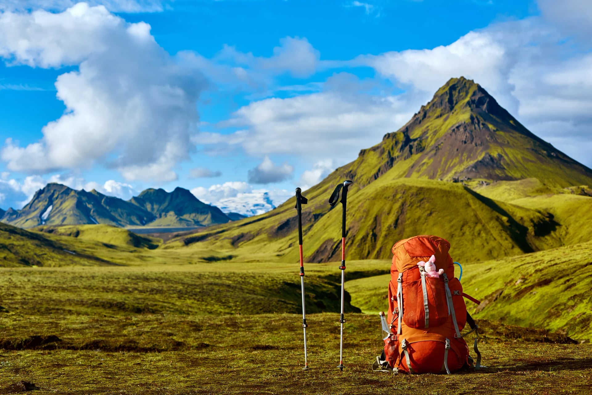
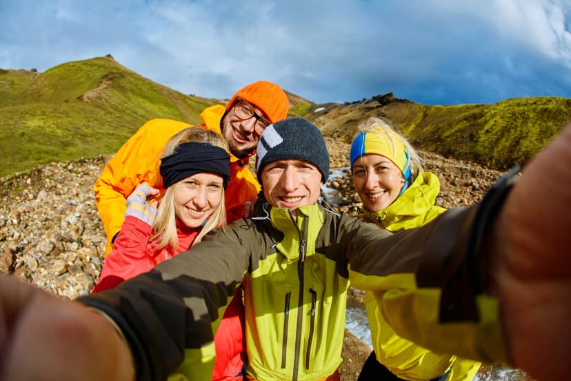
Iceland packs more landscape variety into a four-day walk than most countries fit into an entire trail system.
You can step off a steaming geothermal field at breakfast, ford a glacial river by lunch, and walk on black-sand desert by evening — all on the same route. That density is what makes backpacking in Iceland one of the most beloved hut-to-hut trekking experiences in Europe.
Let’s look at everything you should keep in mind when planning a backpacking trip in Iceland: distance, difficulty, season, costs, and whether the trail suits the kind of hiker you are. An important part of it is being honest about the trade-offs — Iceland is a serious mountain environment, and some of the trails are not beginner-appropriate.
Quick Overview
Weather: Expect rain, wind, and the chance of snow on highland passes in any month. Conditions can swing from sun to sleet within an hour.
Daylight: 21+ hours in late June, dropping to ~13 hours by early September. The "midnight sun" period (mid-June to mid-July) gives you near-unlimited hiking time.
Best season: Most highland trails are walkable from late June to early September. The road to Landmannalaugar (start of the Laugavegur Trail) typically opens in late June and closes in early September, when the mountain huts shut for the winter (Ferðafélag Íslands). Check our month-by-month guide on the best time to hike in Iceland for more in-depth information.
Difficulty: Expect moderate hiking with cold-water river crossings, unpredictable weather, and rough volcanic terrain. Highland trails are not the place to learn the basics.
Permits: No permits are required to hike Iceland's long-distance trails. You do need to book mountain huts well in advance.
Cost: Plan on roughly €600–€1,500 per person for a 4–7 day independent trip excluding flights, depending on accommodation and rented gear.
Who is backpacking in Iceland for?
Best for: Hikers who want a serious adventure with established infrastructure, dramatic landscape change, and 4–8 day route options.
Less ideal for: Total beginners, anyone unwilling to walk in rain, or travelers expecting a fully signposted alpine system. Iceland's highlands are wilder than that.

The 7 Best Backpacking Trails
Quick Picks
Best overall: Laugavegur
Best for solitude: Hornstrandir
Best for first-timers: Laugavegur
Best challenge: Öskjuvegur
Best alternative: Víknaslóðir
The seven trails below cover the full range of Iceland backpacking trails — from the most popular, infrastructure-heavy route (Laugavegur) to the most remote and committing (Hornstrandir).
For a first Iceland trip, the Laugavegur is the right answer for most people: it's the most scenic per kilometer, the easiest to book through a self-guided operator, and the best introduction to what Icelandic highland hiking actually feels like.
If you've already walked the Laugavegur, the question is whether you want solitude (Víknaslóðir, Kjölur), more challenge (Strútsstígur, Fimmvörðuháls), or genuine wilderness (Öskjuvegur, Hornstrandir).
All three categories reward the kind of preparation Iceland demands.

1. Laugavegur Trail
Distance: ~55 km (34 mi) | Days: 4–5 | Difficulty: Moderate | Start/end: Landmannalaugar → Þórsmörk
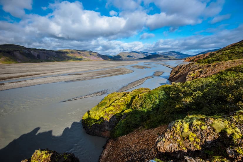
The Laugavegur Trail is the one you've seen in every Iceland Instagram montage, and the hype is earned. In four days you walk through rhyolite mountains streaked orange, green, and pink, across snowfields and obsidian fields, past Lake Álftavatn, through black-sand glacial deserts, and finally down into the birch forests of Þórsmörk. No other trail in Europe compresses this much landscape into one route.
It's the most accessible long-distance trail in Iceland. The route is well-marked, the six mountain huts are spaced roughly every 12–15 km, and a daily bus connects both trailheads to Reykjavík. Most hikers spend 4 days walking; adding a fifth day for the side hike up Brennisteinsalda or the descent into Þórsmörk's inner valleys makes for a richer trip.
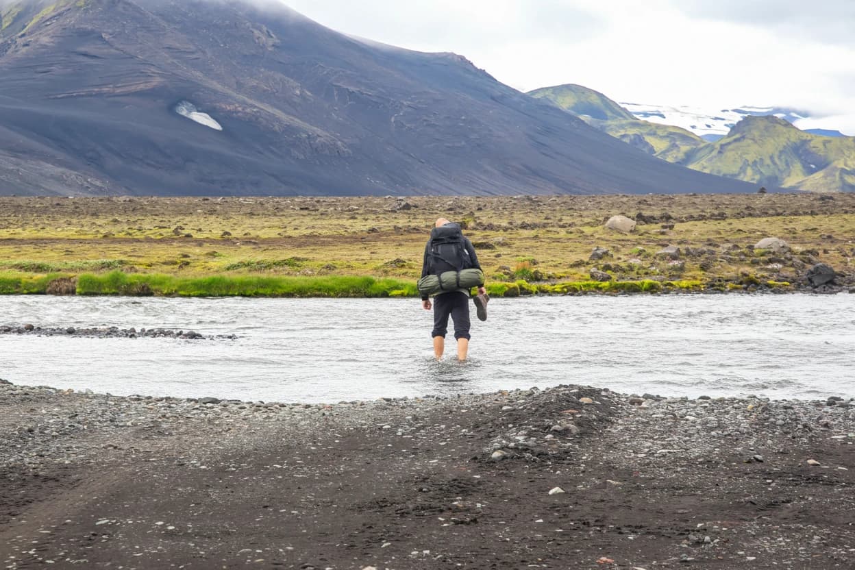
The trade-off: Huts sell out far in advance — most dates for the upcoming season are already booked by autumn the previous year (Ferðafélag Íslands). River crossings are unbridged in places and can be cold and waist-deep in late summer. And because the trail is popular, you will share the huts with many other hikers.
Best for: First-time Iceland backpackers, hikers who want established infrastructure, photographers, anyone who wants to see the classic highland landscapes in one trip.
If you'd rather skip the hassle of booking, check our Laugavegur Trail Tour:
2. Fimmvörðuháls Trail
Distance: ~27 km (17 mi) | Days: 2 | Difficulty: Moderate–strenuous | Start/end: Þórsmörk → Skógar (or reverse)
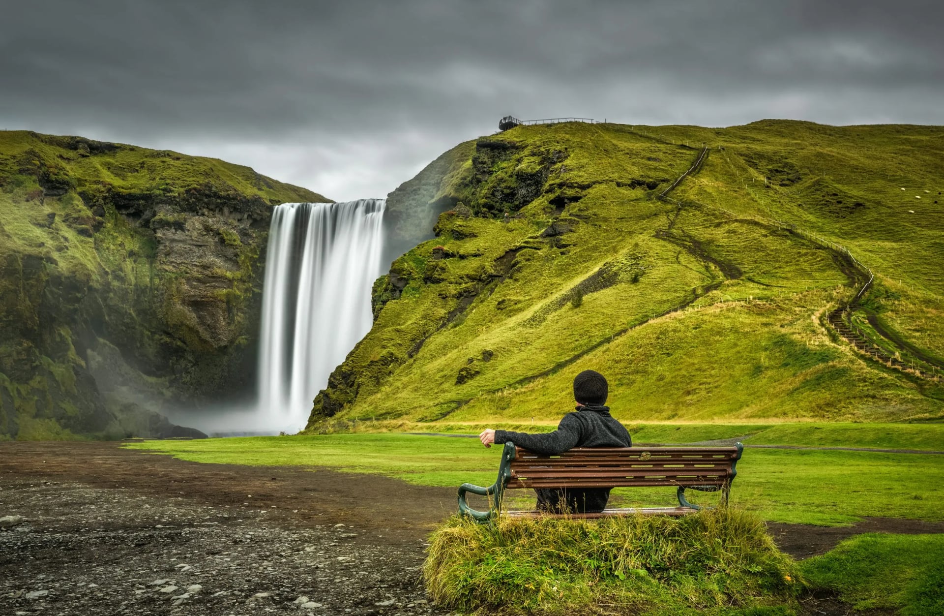
Fimmvörðuháls runs between two glaciers, Eyjafjallajökull and Mýrdalsjökull, crosses the 2010 lava fields, and finishes with a descent past 23 named waterfalls on the Skógá river down to Skógafoss. Many hikers add it as a final day to the Laugavegur Trail, walking the full Skógar-to-Landmannalaugar traverse over six days.
As a standalone, it's the most concentrated dose of Icelandic scenery you can get on a single night. There's a hut at Baldvinsskáli on the pass and another at Fimmvörðuskáli, but both are small, with 16-18 beds, so book early.
The trade-off: It's harder than the Laugavegur Trail per kilometer. The pass tops out at just over 1,100 m and holds snow into July; the southern descent has steep, slippery sections; and weather on the saddle can turn dangerous quickly.
Best for: Hikers who want maximum scenery in minimum time, Laugavegur veterans extending their trip, anyone in good cardiovascular shape who's comfortable in alpine conditions.
3. Víknaslóðir
Distance: ~45 km (28 mi) for the popular section; up to 75 km full | Days: 4–7 | Difficulty: Moderate | Start/end: Borgarfjörður Eystri → Seyðisfjörður (and inlets in between)
If Laugavegur is Iceland's headline act, Víknaslóðir — "the trails of the inlets" — is the deep cut. It runs through deserted fjords on the east coast, past abandoned fishing settlements, and along sea cliffs where puffins nest in summer. Daily distances are gentle, the elevation profile is rolling rather than punishing, and you'll sometimes go a full day without seeing another hiker.
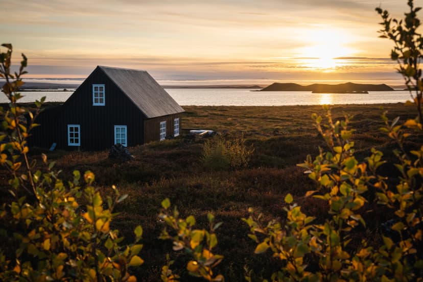
It's also the most culturally rich trail on this list. The huts are former farmsteads and fishing huts converted into mountain accommodation, several of the inlets have small interpretive markers about the families who once lived there, and the sea-facing campsites are some of the most atmospheric in the country.
The trade-off: Access. Borgarfjörður Eystri is an 80-minute drive from Egilsstaðir airport, which is itself an hour's flight from Reykjavík. That extra travel day is the reason most international hikers skip it — and the reason it's still quiet.
Best for: Returning Iceland hikers, photographers, birders (puffin colonies June–August), anyone who prefers solitude over icons.
4. Strútsstígur
Distance: ~50 km (31 mi) | Days: 3–4 | Difficulty: Strenuous | Start/end: Hólaskjól → Hvanngil
Strútsstígur runs roughly parallel to Laugavegur, a few valleys to the east, through the same Fjallabak region. The scenery is almost as dramatic — geothermal hot pools at Strútur, glacial views, lava fields — but you'll see a fraction of the people. This should not be your first Iceland trip. If you have the skills, it's one of the best Iceland backpacking trips in the country.
It pairs naturally with the Laugavegur — many experienced hikers walk Strútsstígur south to Hvanngil, then continue on the Laugavegur to Þórsmörk for a full week of trekking.
The trade-off: The trail is unmarked in long sections. You need to be confident with map and GPS navigation, you need to be self-sufficient in case of weather, and you need to be comfortable with consequential river crossings.
Best for: Experienced highland hikers, anyone who's done the Laugavegur Trail and wants a wilder version, navigation-confident solo hikers.
5. Öskjuvegur (Askja Trail)
Distance: ~100 km (62 mi) | Days: 6–8 | Difficulty: Strenuous | Start/end: Herðubreiðarlindir → Svartárkot
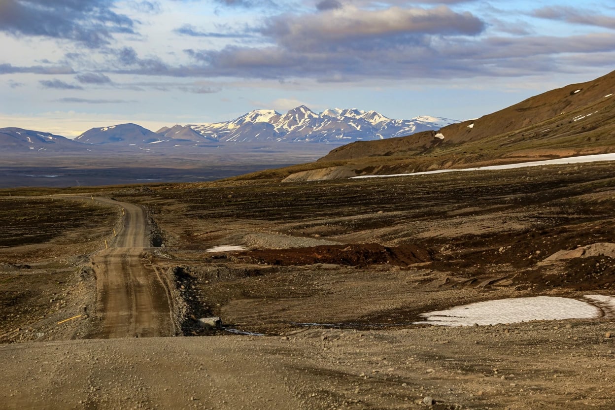
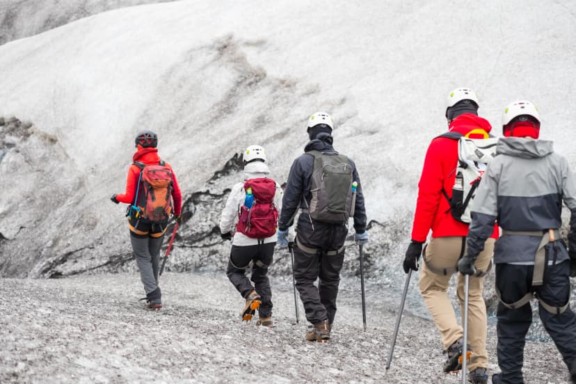
Öskjuvegur crosses Ódáðahraun (Odadahraun), the largest lava field in Iceland, past the Askja caldera and the otherworldly Víti crater lake. The route reaches around 1,300 m, where summer snowstorms are a real possibility, and traverses some of the most remote terrain in the country (Ferðafélag Íslands).
Five huts, all run by the Akureyri Touring Association, space the route — Þorsteinsskáli (Thorsteinsskali), Bræðrafell (Broedrafell), the Drekagil cluster at Askja, Dyngjufell, and Botnar. Most are small (16–55 beds) and book up early, though nothing like Laugavegur levels.
This is backpacking across Iceland in the literal sense — you walk west-to-east across the high interior, on lava and ash, with the country's biggest glaciers visible on the horizon. It's also one of the few trails where the landscape genuinely feels like Mars; NASA used the area to train Apollo astronauts in the 1960s.
The trade-off: At 1,300 m, summer snowstorms with low visibility are routine, the lava plain has almost no shelter and limited water between huts, and reaching the Herðubreiðarlindir (Herdubreidarlindir) trailhead requires a 4×4 transfer over F-roads — there are no buses. Bail-out options mid-route are essentially non-existent.
Best for: Experienced multi-day trekkers, geology enthusiasts, hikers who already know what wet-cold-windy means and want a route that earns serious bragging rights.

6. Hornstrandir Nature Reserve
Distance: Variable; 35–80 km depending on route | Days: 4–8 | Difficulty: Strenuous | Start/end: Boat-in from Ísafjörður; multiple route options
Hornstrandir is a 580 km² peninsula in Iceland's far northwest with no roads, no cell service in most areas, and no permanent residents. You arrive by scheduled summer boat from Ísafjörður (Isafjordur), walk for as many days as your route demands, and get picked up by another boat at a pre-arranged pier. Arctic foxes — protected here and unafraid of humans — are common; sea cliffs at Hornbjarg hold one of the largest seabird colonies in the North Atlantic.
There are no huts on most routes — there are 16 designated tent sites where camping is permitted — and weather can strand boats, so build in buffer days. The reserve has a strict leave-no-trace policy; campfires are forbidden and waste must be packed out. Find more information on the official tourist information website.
The trade-off: No roads, no cell service across most of the reserve, no huts on most routes, and the only way in or out is by scheduled summer boat from Ísafjörður — which weather can cancel for days at a time. Build buffer days into every itinerary.
Best for: Experienced backpackers comfortable with full self-sufficiency, wildlife enthusiasts, anyone with a preference for solitude on the trail.
7. Kjölur
Distance: ~50 km on foot (the historic route is ~200 km) | Days: 3–4 (foot section) | Difficulty: Moderate | Start/end: Hveravellir → Hvítárnes (and onward)
The Kjölur route is the historic highland pass between Iceland's second and third largest glaciers, Langjökull and Hofsjökull. Most modern travelers cross it by 4×4 along Route 35; backpackers walk a 50-km section on foot with stops at the geothermal area of Hveravellir (where Iceland's most famous outlaw, Fjalla-Eyvindur, hid out in the 18th century) and the historic Hvítárnes hut, the oldest FÍ mountain hut in Iceland and reportedly haunted.
The walking is gentler than the Laugavegur — fewer river crossings, less elevation — but the landscape is more austere. Vast gravel plains, glacier views in every direction, almost no vegetation. It's a route that rewards hikers who can find beauty in emptiness.
The trade-off: The scenery is less varied than the Laugavegur, and Route 35 — the gravel highland road — runs alongside parts of the route, which means occasional 4×4 traffic. The walking is also more uniform day-to-day; there is no constant dramatic landscape change between the huts.
Best for: History-curious hikers, anyone wanting a moderate-grade highland trip without the crowds, return visitors who want something different.
When to Go
The highland hiking season in Iceland is short — roughly late June to early September. Outside that window, snow blocks passes, F-roads are closed, and most mountain huts are unmanned and locked.
Trails open as the road to Landmannalaugar clears. Snow lingers on high passes; daylight is at its peak (21+ hours). Mosquitoes haven't appeared yet. Some river crossings are still cold and high from snowmelt.
Peak season. Best weather odds, all huts staffed, full bus schedules running. Also peak crowds and peak prices. Book anything 8–10 months in advance.
Slightly more settled weather and the start of the autumn light. Fewer mosquitoes. Crowds remain heavy through mid-month, then ease.
The shoulder window. Daylight drops to ~13 hours, weather is colder, the Northern Lights become possible again. Some huts close in the first week. Best for experienced hikers who want fewer crowds and don't mind cold nights.
The Icelandic Met Office publishes hiking-relevant forecasts and you can find travel conditions on Safetravel — the official safety service by ICE-SAR — with road and trail status updates. Check both within 24 hours of starting any trail.
Looking for an in-depth comparison on best timing? We cover hiking conditions in Iceland month-by-month in our guide on when to visit.
What Backpacking in Iceland Costs
Iceland is expensive. Plan generously. Indicative 2026 prices*:
Mountain hut (FÍ network): 15,800 ISK / ~€105 / ~$115 per person per night. Current FÍ rates →
Camping (designated sites): 3,200 ISK / ~€21 / ~$23 per person per night
Hot showers at huts: 1,000 ISK / ~€7 / ~$7.50 for both hut and camping guests.
Bus from Reykjavík to Landmannalaugar or Þórsmörk: around ~14,900 ISK / ~€100 / ~$110 one way
Gear rental (sleeping bag, stove, tent) in Reykjavík: ~€80–€150 / ~$90–$165 for a week
A bare-bones, multi-day independent trip on the Laugavegur — camping, self-catering, public bus — comes in around €450–€600 / ~$495–$660 excluding flights and food.
A hut-based independent trip runs €750–€950 / ~$825–$1,045.
A self-guided package with everything booked runs €1,000–€1,600 / ~$1,100–$1,760.
Hotels, flights, and car rental in Iceland are markedly cheaper outside the June–August peak — often 30–40 % less. The exception is the hiking-trip-specific costs: FÍ mountain huts, designated highland campsites, and Reykjavík-to-trailhead buses are flat-priced through the year (and the buses simply don't run outside summer).
*Prices verified April 2026. FÍ huts and highland buses adjust their rates annually; check respective websites for current figures.
Gear Essentials
Iceland punishes underpacking. Below are the non-negotiables:
Waterproof hardshell jacket and pants — not "water-resistant", fully waterproof. You will hike in the rain.
Insulating layer (down or synthetic puffy). Highland nights drop near freezing even in July.
Sturdy, broken-in waterproof hiking boots with ankle support.
River-crossing shoes — lightweight neoprene booties or sandals. Crossing barefoot is how you get hypothermia.
Trekking poles — essential for river crossings and the Fimmvörðuháls descent.
Sleeping bag rated to at least 0 °C / 32 °F, even for hut stays. Huts provide bunks but no bedding.
Headlamp (yes, even with the midnight sun — for inside huts and shoulder-season trips).
Map and GPS device — phones lose signal and battery. The Ferðafélag Íslands Hálendiskort (Highland Map) is the standard reference.
Cash and cards — some huts charge for showers in cash; rural fuel stations sometimes only take cards.
What to leave behind: cotton, ultralight summer-only gear, anything you can't afford to get soaked.

Permits, Rules, and Safety
You do not need a permit to hike any of Iceland's long-distance trails. What you do need:
Hut bookings, made well in advance through Ferðafélag Íslands for the Laugavegur Trail and many highland routes, or the Akureyri Touring Association for Öskjuvegur.
A trip plan filed with Safetravel for any remote route you walk solo or not as part of an organized tour (for those, it is recommended for tour operators to submit the plan). It's free, takes ten minutes, and triggers a search if you don't check in on the chosen return date.
Strict adherence to the no-camping-outside-designated-areas rule in nature reserves like Þórsmörk and Hornstrandir. Iceland's vegetation is fragile and recovery from off-trail damage takes decades.
Awareness that emergency rescue is voluntary and weather-dependent. ICE-SAR (the Icelandic Association for Search and Rescue) is world-class but reaches you in the shortest time possible, not immediately after the call. Self-sufficiency matters.
For specific, reliable advice on gear, safety measures, travel conditions and other helpful information, see our other guides and FÍ page for information on huts.
Self-guided or Guided, Solo or in a Group?
Two questions matter once you've picked a trail: how much support do you want on the route, and who do you want to walk it with?
Most hikers who decide on self-guided want the freedom of an independent trip but don't want to spend the autumn refreshing the booking sites.
For most, the preferred way is with a partner or a few friends — the freedom of an independent trip and the safety of numbers, without the set pace of a large group.
Booking Your Backpacking Trip
If you'd like the trip booked, the huts secured, and the logistics handled — without giving up the feel of walking it yourself — take a look at our hut-to-hut hiking tours in Iceland.
We've built our tours specifically to take the booking lottery out of the equation, and to provide the most adaptable and carefree backpacking experience possible.
Have more questions? Get in touch with us — we will be happy to find the best trail for you and provide any further information.

About this author
Jon is our travel advisor and an outdoor adventurer who is happiest on the move. While mountain biking is his personal passion, he thrives on crafting hiking adventures for others — planning routes and adding the little touches that turn a trip into a core memory.


.jpeg&w=828&q=75)